The Ocean Noise Strategy supports NOAA’s development of decision support tools for assessment, planning and mitigation of noise-making activities over ecologically-relevant scales. These activities have been increasing since the initiation of the Strategy, with additional efforts developing focused tools that compile and visualize marine species distributions, soundscapes, and NOAA-permitted or authorized activities to assist managers, scientists, stakeholders, and the public in decision making.
The following are examples of decision support tools that support implementation of the Ocean Noise Strategy:
SanctSound Web Portal
The results of a 2018-2022 collaborative effort between NOAA and the US Navy to better understand underwater sound within the US National Marine Sanctuaries are available via an interactive web portal. This resource includes all recording data and standardized outputs to demonstrate the way SanctSound informs management of underwater noise in National Marine Sanctuaries.
SoundCoop 
This 3 year project, supported by NOAA’s Integrated Ocean Observing System program, US Navy, and BOEM, is led by NOAA’s National Center for Environmental Information to advance community practice for passive acoustic monitoring (PAM) data archiving, access, connectivity, and application. This effort aims to advance standardization and utility of PAM data to develop outreach capacity and support analysis and interpretation of soundscape metrics across the federal agencies.
Passive Acoustic Cetacean Map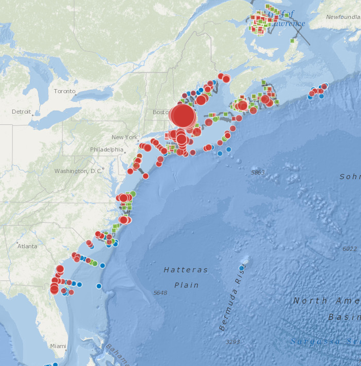
This interactive mapping tool presents passive acoustic detections of numerous marine mammal species from 2004 to present, providing information about marine mammal distribution and long-term trends. In 2024, the tool was expanded from a regional to a national scope.
Marine Mammal Data Availability
Current marine mammal density, distribution, and occurrence data are provided by regions of the US Exclusive Economic Zone (EEZ). An interactive geospatial tool allows for the quantitative integration, analysis, and depiction of specific marine mammal density datasets available for the USEEZ and beyond.
Biologically Important Areas (BIA) 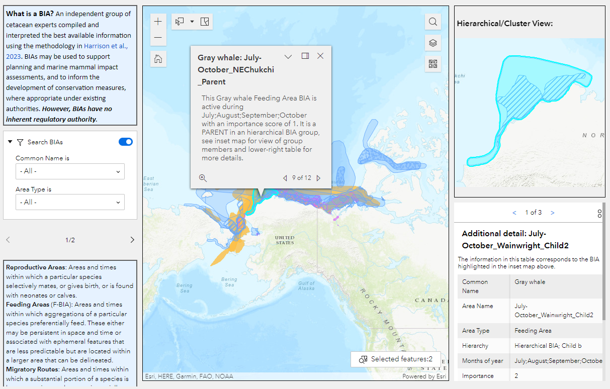
BIAs represent areas and times in which cetaceans (whales, dolphins, and porpoises) are known to concentrate for activities related to reproduction, feeding, and migration, as well as the known ranges of small and resident populations. BIAs are used by NOAA, other federal agencies, and the public to support environmental planning, compliance, and protection. In 2023, improved methods and scoring protocols for BIAs were published along with updated results for most regions (completion expected by 2024).